Craigieburn Range — Avalanche Forecast
Welcome to Winter 2026. We still need a little more snow to go sliding but great conditions for a winter walk. Now is the perfect time to get out your avalanche gear and get ready for the season. Keep up the snow dances.
Danger by Elevation
Active Avalanche Problems
No recent activity reported. Monday: North of the Mackenzie Basin: Mostly cloudy with occasional drizzle, confined to the foothills by evening. Elsewhere: Areas of morning cloud and frost clearing to fine. Light winds. Freezing level 1400m.Tuesday: Fine with light winds. Freezing level 2100m. Watch for frozen water ice beneath snow.
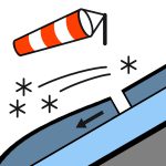
20cm of snow fell 24-25/06, which came with strong Southerly winds. Cover is very over the previous surface which was predominantly ground throughout the forecast region.
Source: New Zealand Avalanche Advisory · View Original Bulletin
Original (EN)
Open in the Avycast appNearby Regions
- Arthur's Pass · 29 km
- Mt Hutt · 31 km
- Two Thumbs · 101 km
- Aoraki/Mt Cook · 128 km
- Nelson Lakes · 162 km
- Ohau · 188 km