 AVYCAST
Two Thumbs — Avalanche Forecast
Avalanche danger in Two Thumbs (New Zealand) is 3 — Considerable, valid for Sunday, September 27, 2026. Published by New Zealand Avalanche Advisory.
Significant new snow will rapidly increase the avalanche hazard on Sunday. It's best to stay out of avalanche terrain until the clearance.
Danger by Elevation
Active Avalanche Problems
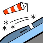
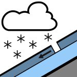
No recent avalanches have been reported in the area. If you see any activity on the Two Thumb Range, please make a public observation. It helps us to produce accurate forecasts. Snow developing before dawn, heavy at times above 400 metres, easing to isolated showers in the morning and clearing in the afternoon.Wind at 1000 metresWesterly 45 km/h, turning southwesterly 30 km/h in the morning.Wind at 2000 metresWesterly gale 80 km/h, rising to severe gale 100 km/h in exposed places before dawn, then easing to southwesterly 55 km/h in the morning.Freezing level2400 metres, lowering rapidly to 800 metres before dawn. The new snow will go someway towards easing the sliding danger. However, windstripped slopes are likely to remain firm with lots of rocks in the runouts. Carrying ski crampons, ice axe and boot crampons and careful evaluation to the conditions is recommended.
More than 20cm of snow is expected on Sunday. It will be distributed by strong SW winds into deep drifts. Prior to this snowfall the snow pack was as follows: Sunny aspects: Mostly bare ground below about 1800m. What little snow is left has gone through multiple melt freeze cycles. Shady aspects: The eastern half has good snow cover above 1600m, reaching 100–120 cm in sheltered spots. Around 40cm on south to southwest slopes. Patches of wind drifted cold snow exist around ridges and terrain features. There are multiple crust layers in the shady snowpack interspersed with weak crystals. This structure is not a problem at present, but could cause elevated avalanche hazard with future loading. Photos from Camp Stream area on Wednesday.
Source: New Zealand Avalanche Advisory · View Original Bulletin
Original (EN)
Frequently asked questions
What does avalanche danger level 3 (Considerable) mean?
Dangerous avalanche conditions — a single person can trigger avalanches on many steep slopes; cautious route selection is essential.
How often is the Two Thumbs forecast updated?
Avycast refreshes hourly; the bulletin is republished by New Zealand Avalanche Advisory usually once a day during the season.
Who publishes the Two Thumbs avalanche forecast?
New Zealand Avalanche Advisory — the official warning service. Avycast aggregates and translates it; always check the original bulletin.
Nearby Regions
- Aoraki/Mt Cook · 45 km
- Mt Hutt · 78 km
- Ohau · 87 km
- Craigieburn Range · 101 km
- Arthur's Pass · 118 km
- Aspiring · 173 km