 AVYCAST
Craigieburn Range — Lawinenlagebericht
Die Lawinengefahr in Craigieburn Range (Neuseeland) ist 3 — Erheblich, gültig für Montag, 28. September 2026. Veröffentlicht von New Zealand Avalanche Advisory.
Schneefall im Frühjahr verbindet sich in der Regel gut, doch die September-Sonne erhöht die Gefahr durch lockeren, nassen Schnee schnell, wenn sie am Nachmittag auftritt.
Gefahr nach Höhenlage
Aktive Lawinenprobleme
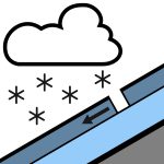

In den letzten 48 Stunden wurden keine Meldungen gemacht. Sonntag: Am Morgen entwickeln sich Regenfälle, möglicherweise stark, und fallen oberhalb von 500 m als Schnee. Der Regen lässt am Nachmittag nach und klingt am Abend ab. Westliche Winde drehen am Morgen nach Südwesten. Die Schneefallgrenze liegt bei 800 m. Montag: Einzelne Schauer, mit zunehmenden bewölkten Phasen. Starke West- bis Südwinde. Die Schneefallgrenze steigt am Morgen von 1000 m auf 1400 m. Eispickel und Steigeisen werden empfohlen, da die Schneedecke besonders am Morgen hart sein kann und sich im Laufe des Tages aufweicht. Skisteigeisen sind nützlich, wenn man mit Ski oder Snowboard unterwegs ist.
Die Schneedecke im Vorhersagegebiet ist äußerst variabel. In manchen Gebieten bis zu 150 cm, in anderen nur auf eisüberzogenen Felsen. Die Schneedecke ist jetzt in allen Bereichen unter 1800 m isotherm. Warmes Wetter in den letzten Wochen hat eine Frühjahrsähnliche Schneedecke geschaffen. Ein gutes Schmelz- und Gefrierzyklus sorgt für gutes 'Corn Skiing'. Über Nacht und am 23.09. fielen 10 cm leichter, trockener Schnee, am 24.09. weitere 8 cm.
Quelle: New Zealand Avalanche Advisory · Original-Lagebericht ansehen
Übersetzt (EN)
Häufige Fragen
Was bedeutet Lawinengefahrenstufe 3 (Erheblich)?
Kritische Lawinensituation — eine einzelne Person kann an vielen Steilhängen Lawinen auslösen; vorsichtige Routenwahl ist unerlässlich.
Wie oft wird der Lagebericht für Craigieburn Range aktualisiert?
Avycast aktualisiert stündlich; New Zealand Avalanche Advisory veröffentlicht den Lagebericht in der Saison meist einmal täglich neu.
Wer veröffentlicht den Lawinenlagebericht für Craigieburn Range?
New Zealand Avalanche Advisory — der offizielle Lawinenwarndienst. Avycast bündelt und übersetzt ihn; prüfe immer den Originalbericht.
Regionen in der Nähe
- Arthur's Pass · 29 km
- Mt Hutt · 31 km
- Two Thumbs · 101 km
- Aoraki/Mt Cook · 128 km
- Nelson Lakes · 162 km
- Ohau · 188 km