Aoraki/Mt Cook — Avalanche Forecast
As we head into true winter we are set to change the elevation bands at the start of July. From the first they will reflect High Alpine as above 2000m. Mid Alpine 2000m - 1500m and Sub Alpine as below 1500m. We will try to give some written guidance on which band we are talking about as we begin the transition.
Danger by Elevation
Active Avalanche Problems
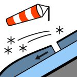
Just a couple of Loose wet size 2 near Mt Darwin on the 27th. If you have observed any recent avalanche activity in the area, please submit a public observation to help keep conditions up to date. Mostly Fine. Southerly 30 km/h dying out before dawn. A Freezing level around 1800m. Ice axe and crampons are essential when travelling above the snowline.
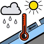
The previous storm from a couple of weeks back brought 30-50cm of new snow, landing on a firm rain saturated crust from late May. At around 2400m there has been significant wind blasted new snow above the previous bullet proof layer. Quite a bit of this new snow and rain has fallen on the 19th and 20th with up to 100cm at the very highest elevations falling as snow possible by the end of the storm .Wednesday brought up to 50cm near the divide at Kelman (2400m), more lieke 10cm at 1200m near the Darwin Glacier confluence. 10-40cm at ridgeline near Mueller hut on Friday.
Source: New Zealand Avalanche Advisory · View Original Bulletin
Original (EN)
Open in the Avycast appNearby Regions
- Two Thumbs · 45 km
- Ohau · 77 km
- Mt Hutt · 113 km
- Craigieburn Range · 128 km
- Arthur's Pass · 136 km
- Aspiring · 147 km