 AVYCAST
Craigieburn Range — Bollettino valanghe
Il pericolo valanghe in Craigieburn Range (Nuova Zelanda) è 3 — Marcato, valido per lunedì 28 settembre 2026. Pubblicato da New Zealand Avalanche Advisory.
La neve in primavera di solito si compatta bene, ma il sole di settembre aumenterà rapidamente il pericolo di lastra da vento umida se si presenta nel pomeriggio.
Pericolo per quota
Problemi valanghivi attivi
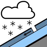

Nessun evento segnalato nelle ultime 48 ore. Domenica: Pioggia in sviluppo al mattino, possibilmente intensa e che cade come neve sopra i 500m. La pioggia diminuisce nel pomeriggio e si dissolve in serata. Venti da ovest che si spostano a sud-ovest al mattino. Livello di neve stabile a 800m. Lunedì: Piovaschi isolati, con periodi di nuvolosità crescente. Venti forti da ovest a sud-ovest. Livello di neve stabile a 1000m, in aumento fino a 1400m al mattino. Si consiglia l'uso di piccozza e ramponi poiché la superficie della neve può essere dura, specialmente al mattino, poi si ammorbidisce durante il giorno. I ramponi da sci saranno utili se si avventura con gli sci o lo snowboard.
La copertura nevosa nell'area di previsione è estremamente variabile. Fino a 150cm in alcune zone, fino a rocce coperte di brina in altre. Il manto nevoso è ora isotermico in tutte le aree sotto i 1800m. Il clima caldo delle ultime settimane ha creato un manto nevoso tipico di primavera. Si è verificato un buon ciclo di fusione e congelamento, favorendo un buon 'corn skiing'. Durante la notte e il 23/09 sono caduti 10cm di neve leggera e asciutta, con ulteriori 8cm il 24/09.
Fonte: New Zealand Avalanche Advisory · Vedi bollettino originale
Tradotto (EN)
Domande frequenti
Che cosa significa il grado di pericolo valanghe 3 (Marcato)?
Condizioni critiche — una singola persona può staccare valanghe su molti pendii ripidi; è indispensabile una scelta prudente dell'itinerario.
Con quale frequenza viene aggiornato il bollettino di Craigieburn Range?
Avycast aggiorna ogni ora; New Zealand Avalanche Advisory ripubblica il bollettino di solito una volta al giorno durante la stagione.
Chi pubblica il bollettino valanghe di Craigieburn Range?
New Zealand Avalanche Advisory — il servizio valanghe ufficiale. Avycast lo aggrega e lo traduce; consulta sempre il bollettino originale.
Regioni vicine
- Arthur's Pass · 29 km
- Mt Hutt · 31 km
- Two Thumbs · 101 km
- Aoraki/Mt Cook · 128 km
- Nelson Lakes · 162 km
- Ohau · 188 km