 AVYCAST
Craigieburn Range — Bulletin d'avalanche
Le danger d'avalanche en Craigieburn Range (Nouvelle-Zélande) est 3 — Marqué, valable pour lundi 28 septembre 2026. Publié par New Zealand Avalanche Advisory.
La neige au printemps adhère généralement bien, mais le soleil de septembre augmentera rapidement le risque de plaque à vent humide si celui-ci apparaît dans l’après-midi.
Danger par altitude
Problèmes d'avalanches actifs
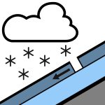

Aucun incident signalé au cours des 48 dernières heures. Dimanche : Pluie en développement le matin, pouvant être forte et tomber sous forme de neige au-dessus de 500 m. La pluie faiblit dans l’après-midi et se dégage en soirée. Vents d’ouest tournant au sud-ouest le matin. Niveau de gel à 800 m. Lundi : Averses isolées, avec des périodes de nuages croissants. Vents forts d’ouest à sud-ouest. Niveau de gel à 1000 m, montant à 1400 m le matin. Il est recommandé d’utiliser un piolet et des crampons, car la surface de la neige peut être dure, surtout le matin, puis ramollir au cours de la journée. Les crampons pour skis seront utiles si vous pratiquez le ski ou le snowboard.
La couverture neigeuse dans la zone de prévision est très variable. Jusqu’à 150 cm dans certaines zones, jusqu’à des rochers recouverts de givre dans d’autres. Le manteau neigeux est désormais isotherme dans toutes les zones en dessous de 1800 m. Le temps chaud des dernières semaines a créé un manteau neigeux de type printanier. Un bon cycle de fonte et de regel est en cours, permettant un bon « ski sur corniche ». 10 cm de neige légère et sèche sont tombés durant la nuit et le 23/09, avec 8 cm supplémentaires le 24/09.
Source: New Zealand Avalanche Advisory · Voir le bulletin d'origine
Traduit (EN)
Questions fréquentes
Que signifie le niveau de danger d'avalanche 3 (Marqué) ?
Conditions dangereuses — une seule personne peut déclencher des avalanches sur de nombreuses pentes raides ; la prudence dans le choix de l'itinéraire est essentielle.
À quelle fréquence le bulletin de Craigieburn Range est-il mis à jour ?
Avycast actualise toutes les heures ; New Zealand Avalanche Advisory republie le bulletin généralement une fois par jour pendant la saison.
Qui publie le bulletin d'avalanche de Craigieburn Range ?
New Zealand Avalanche Advisory — le service d'alerte officiel. Avycast l'agrège et le traduit ; consultez toujours le bulletin original.
Régions à proximité
- Arthur's Pass · 29 km
- Mt Hutt · 31 km
- Two Thumbs · 101 km
- Aoraki/Mt Cook · 128 km
- Nelson Lakes · 162 km
- Ohau · 188 km