Aspiring — Avalanche Forecast
Shallow pockets of wind slab may exist at higher elevations after Monday's southerly front. Most areas across the region remain shallow, rocky and bare; however, snow is starting to accumulate at higher elevations. Utilise this time by giving your equipment a good check, refreshing your skills and staying motivated for a great season ahead!
Danger by Elevation
Active Avalanche Problems
There have been no avalanche observations in the Aspiring region so far this winter. If you see any recent avalanche occurrences or have any relevant snowpack information or photo's, you can share these on the Public Observations link on the NZAA home page. Mainly fine, a front starts to build over the Tasman later in the week and is due to arrive later on Friday. For an updated daily forecast, you can visit the Metservice link below. Firm icy conditions are likely in many areas. Ice axe and crampons are recommended.
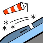
A light dusting of snow on Monday, along with cold southerly winds, has covered an unseasonably shallow snowpack across the region. There is currently little to no snow below around 1900m. Between 1900-2400m, gullies and leeward catch features will filling in. Any new or recent snow will most likely be over a very firm, icy base. Significantly more snow may have accumulated above 2400.
Source: New Zealand Avalanche Advisory · View Original Bulletin
Original (EN)
Open in the Avycast appNearby Regions
- Wanaka · 25 km
- Queenstown · 53 km
- Ohau · 90 km
- Fiordland · 108 km
- Aoraki/Mt Cook · 147 km
- Two Thumbs · 173 km