 AVYCAST
Aoraki/Mt Cook — Lawinenlagebericht
Die Lawinengefahr in Aoraki/Mt Cook (Neuseeland) ist 3 — Erheblich, gültig für Sonntag, 27. September 2026. Veröffentlicht von New Zealand Avalanche Advisory.
Ein bedeutender Sturm zieht am Sonntagmorgen durch. Im Frühjahr werden diese Stürme von schnellem Temperaturanstieg begleitet, was die Wahrscheinlichkeit für natürliche Lawinen erhöhen kann. Vermeiden Sie windbelastetes Lawinengelände und achten Sie auf lockeren, nassen Lawinenabgang aus steilen, sonnigen Hängen, falls die Sonne am Nachmittag hervorkommt.
Gefahr nach Höhenlage
Aktive Lawinenprobleme
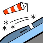

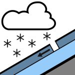
In den letzten 48 Stunden wurden keine neuen Lawinen beobachtet. Schnee, möglicherweise schwer, am Nachmittag nachlassend und bis zum Abend klar. Wind in 1000 Metern: Nordwind 50 km/h, zeitweise Sturmstärke 70 km/h vor der Dämmerung, dann wechselnd auf Südwestwind 40 km/h am Morgen. Wind in 2000 Metern: Nordweststurm 70 km/h, vor der Dämmerung wechselnd auf Südwester 50 km/h. Wind in 3000 Metern: Schwerer Nordweststurm 90 km/h, am Morgen wechselnd auf Südwestersturm 70 km/h. Frostgrenze: 1800 Meter, schnell sinkend auf 800 Meter vor der Dämmerung, am Abend steigend auf 1100 Meter. Es gibt glatte, harte Wechten im gesamten Vorhersagegebiet unter etwa 2400 m. Trotz des neuen Schnees am Sonntag können starke bis stürmische Winde diese Wechten freilegen. Steigeisen und Eispickel werden empfohlen.
Rund 40 cm Neuschnee wurden am 24. und 25. über dem Bereich um den Divide in etwa 1800 m Höhe gefallen, wobei die Schneemenge in niedrigeren Lagen und südlich des Liebig-Gebirges abnimmt. Dieser Schnee wurde am Samstag durch Sturmwinde aus Westen umverteilt, wodurch tiefere Schneeschichten und Triebschnee auf geschützten, östlich exponierten Hängen entstanden, und liegt auf einer 5 cm dicken Regenkruste vom 21. September bis 2400 m. Die gleichen Sturmwinde aus Westen haben die westseitigen Hänge bis auf diese Kruste zurückgestript. Wärmere Temperaturen, Greenhousing und bis zu 10 mm Niederschlag am Samstag haben die Schneedecke mit einer dünnen Schmelz-Frost-Schicht bis etwa 2300 m bedeckt. Der untere Schneedeckenteil ist im Allgemeinen gut gesetzt.
Quelle: New Zealand Avalanche Advisory · Original-Lagebericht ansehen
Übersetzt (EN)
Häufige Fragen
Was bedeutet Lawinengefahrenstufe 3 (Erheblich)?
Kritische Lawinensituation — eine einzelne Person kann an vielen Steilhängen Lawinen auslösen; vorsichtige Routenwahl ist unerlässlich.
Wie oft wird der Lagebericht für Aoraki/Mt Cook aktualisiert?
Avycast aktualisiert stündlich; New Zealand Avalanche Advisory veröffentlicht den Lagebericht in der Saison meist einmal täglich neu.
Wer veröffentlicht den Lawinenlagebericht für Aoraki/Mt Cook?
New Zealand Avalanche Advisory — der offizielle Lawinenwarndienst. Avycast bündelt und übersetzt ihn; prüfe immer den Originalbericht.
Regionen in der Nähe
- Two Thumbs · 45 km
- Ohau · 77 km
- Mt Hutt · 113 km
- Craigieburn Range · 128 km
- Arthur's Pass · 136 km
- Aspiring · 147 km