 AVYCAST
Aoraki/Mt Cook — Bulletin d'avalanche
Le danger d'avalanche en Aoraki/Mt Cook (Nouvelle-Zélande) est 3 — Marqué, valable pour mardi 17 novembre 2026. Publié par New Zealand Avalanche Advisory.
Traduction en cours — affiché en langue source
Heavy rain has arrived, expect loose wet and wet slab activity to increase, and windslab to develop up high. Ice cliffs and rock fall have been active over the week, some have triggered large avalanches.
Danger par altitude
Problèmes d'avalanches actifs
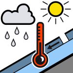
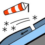
A size 2 wet slab was reported below Cinerama Col on a Sw aspect, 2000m elevation, November 14 Reports of loose wet avalanching up to size 1.5 at the head of the Tasman on November 12, on most aspects. A size 4 wet slab was observed to have run into the Tasman valley next to the Freshfield Glacier on November 8, triggered by rockfall. It was triggered at about 2000m elevation and ran about 1500m distance and around 800m vertical. ForecastHeavy rain with snow to 2700 metres, clearing to fine in the afternoon.Wind at 1000 metresNorthwesterly 55 km/h, dying out in the morning.Wind at 2000 metresNorthwesterly severe gale 100 km/h, easing to gale 70 km/h in the morning, then to in the afternoon, then dying out in the evening.Wind at 3000 metresNorthwesterly severe gale 95 km/h, easing to gale 70 km/h in the morning, then to 50 km/h in the afternoon.Freezing level3100 metres, lowering to 1800 metres in the afternoon. An ice axe and crampons are essential for safe travel on snow in spring conditions.
A wet and warm early November has left the pack below 2500m moist, with plenty of rain falling. Conditions at higher elevations will be more layered where recent precipitation fell as snow. There has been significant snow loss at lower elevations. Heavy rain is overnight Sunday and into Monday will further weaken mid and low elevation snow, while windslab will develop above .
Source: New Zealand Avalanche Advisory · Voir le bulletin d'origine
Original (EN)
Questions fréquentes
Que signifie le niveau de danger d'avalanche 3 (Marqué) ?
Conditions dangereuses — une seule personne peut déclencher des avalanches sur de nombreuses pentes raides ; la prudence dans le choix de l'itinéraire est essentielle.
À quelle fréquence le bulletin de Aoraki/Mt Cook est-il mis à jour ?
Avycast actualise toutes les heures ; New Zealand Avalanche Advisory republie le bulletin généralement une fois par jour pendant la saison.
Qui publie le bulletin d'avalanche de Aoraki/Mt Cook ?
New Zealand Avalanche Advisory — le service d'alerte officiel. Avycast l'agrège et le traduit ; consultez toujours le bulletin original.
Régions à proximité
- Two Thumbs · 45 km
- Ohau · 77 km
- Mt Hutt · 113 km
- Craigieburn Range · 128 km
- Arthur's Pass · 136 km
- Aspiring · 147 km