 AVYCAST
Ohau — Bollettino valanghe
Il pericolo valanghe in Ohau (Nuova Zelanda) è 3 — Marcato, valido per lunedì 28 settembre 2026. Pubblicato da New Zealand Avalanche Advisory.
Una tempesta fredda a rapido movimento porterà abbondante neve a bassi livelli domenica. Il pericolo di valanghe aumenterà con l'accumulo di neve fresca e successivamente con il suo riscaldamento. Prenditi il tempo di valutare quanto bene la nuova neve si stia legando e sii consapevole di quanto rapidamente possa riscaldarsi quando esposta al sole.
Pericolo per quota
Problemi valanghivi attivi
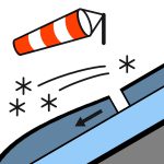

Non sono state segnalate recenti osservazioni di valanghe nelle ultime 48 ore. A sud di Arthurs Pass: Neve in sviluppo prima dell'alba, a tratti abbondante sopra i 400 metri, attenuandosi a piogge isolate al mattino e con tempo sereno nel pomeriggio. Altrove: Pioggia in sviluppo al mattino, possibilmente abbondante e che cade come neve sopra i 500 metri. La pioggia si attenua nel pomeriggio e si dissolve in serata. vento in quota da sud-ovest 50 km/h. livello di congelamento 600 salendo a 1200 metri nel pomeriggio. Un grave pericolo di valanghe di slittamento esiste al mattino quando il manto nevoso è ricongelato duro. Porta con te una picozza e ramponi, e assicurati di saperli usare efficacemente. Considera le conseguenze di una caduta prima di impegnarti in terreni ripidi.
Il manto nevoso è generalmente ben consolidato e presenta un carattere tipico di primavera — compatto e duro al mattino, poi gradualmente che si ammorbidisce con l'aumento delle temperature durante il giorno.
Fonte: New Zealand Avalanche Advisory · Vedi bollettino originale
Tradotto (EN)
Domande frequenti
Che cosa significa il grado di pericolo valanghe 3 (Marcato)?
Condizioni critiche — una singola persona può staccare valanghe su molti pendii ripidi; è indispensabile una scelta prudente dell'itinerario.
Con quale frequenza viene aggiornato il bollettino di Ohau?
Avycast aggiorna ogni ora; New Zealand Avalanche Advisory ripubblica il bollettino di solito una volta al giorno durante la stagione.
Chi pubblica il bollettino valanghe di Ohau?
New Zealand Avalanche Advisory — il servizio valanghe ufficiale. Avycast lo aggrega e lo traduce; consulta sempre il bollettino originale.
Regioni vicine
- Aoraki/Mt Cook · 77 km
- Two Thumbs · 87 km
- Wanaka · 90 km
- Aspiring · 90 km
- Queenstown · 101 km
- Mt Hutt · 164 km