 AVYCAST
Arthur's Pass — Bollettino valanghe
Il pericolo valanghe in Arthur's Pass (Nuova Zelanda) è 3 — Marcato, valido per martedì 29 settembre 2026. Pubblicato da New Zealand Avalanche Advisory.
La previsione di neve per domani aumenterà il rischio di lastra da tempesta man mano che la giornata progredisce. Si prevede che il livello di congelamento scenderà; pertanto, ci si aspetta un aumento del pericolo a tutte le quote. I totali nel bacino di Tempe supererebbero i 25 cm nelle prossime 24 ore. Sono necessarie buone capacità di valutazione per un pericolo in evoluzione con qualsiasi escursione in montagna domani.
Pericolo per quota
Problemi valanghivi attivi
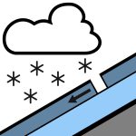

Niente segnalato nelle ultime 24 ore. Per favore, continuate a inviare queste osservazioni pubbliche! Sono una risorsa preziosa per gli utenti delle montagne e molto utili per noi nella previsione. Quindi, si prega di segnalare eventuali valanghe che vedete o incontrate nella sezione delle osservazioni pubbliche del sito web NZAA. La pioggia, a tratti intensa e che cade come neve sopra gli 800 metri, si attenua nel pomeriggio con qualche rovescio isolato. Venti da nord-ovest a 40 km/h che cambiano a sud a 30 km/h a metà mattina. Il livello di congelamento è a 1000 metri, in aumento a 1300 metri nel pomeriggio. La pioggia ammorbidirà il manto nevoso al mattino. Da circa una settimana si verifica un ciclo di fusione/ripreparazione. L'uso di ramponi e piccozza è consigliato.
Il manto nevoso è generalmente ben consolidato, con pioggia alle quote più alte all'inizio della settimana. Le recenti nevicate hanno depositato fino a 15 cm a quote superiori ai 2100 m, ma questa quantità varia in base alla posizione, con ogni valle che presenta totali differenti. La neve fresca alle quote più alte è ben consolidata.
Fonte: New Zealand Avalanche Advisory · Vedi bollettino originale
Tradotto (EN)
Domande frequenti
Che cosa significa il grado di pericolo valanghe 3 (Marcato)?
Condizioni critiche — una singola persona può staccare valanghe su molti pendii ripidi; è indispensabile una scelta prudente dell'itinerario.
Con quale frequenza viene aggiornato il bollettino di Arthur's Pass?
Avycast aggiorna ogni ora; New Zealand Avalanche Advisory ripubblica il bollettino di solito una volta al giorno durante la stagione.
Chi pubblica il bollettino valanghe di Arthur's Pass?
New Zealand Avalanche Advisory — il servizio valanghe ufficiale. Avycast lo aggrega e lo traduce; consulta sempre il bollettino originale.
Regioni vicine
- Craigieburn Range · 29 km
- Mt Hutt · 59 km
- Two Thumbs · 118 km
- Aoraki/Mt Cook · 136 km
- Nelson Lakes · 142 km
- Ohau · 203 km