 AVYCAST
Queenstown — Avalanche Forecast
Avalanche danger in Queenstown (New Zealand) is 3 — Considerable, valid for Sunday, September 27, 2026. Published by New Zealand Avalanche Advisory.
Recently formed Windslabs will be reactive this morning. Avoid areas of obvious loading and poor run outs. Expert terrain analysis and decision making will be needed for safe backcountry travel first thing. Although cold, Loose Wet avalanches will be possible if the sun makes an appearance.
Danger by Elevation
Active Avalanche Problems
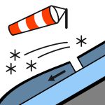

None reported yesterday. Gale NW winds trending SW in the morning. Snow easing slowly throughout day. Cold temps with the FAFL dropping to 700m. Areas where the wind has stripped away the new snow will be very slick. Exposed West facing slopes will be areas to avoid.
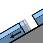
10-20cm new snow to low elevation overnight. Likely loading up to 80cm on lee slopes. Expecting a reasonable bond to the warm/wet old surface in most areas. This falls onto a wet upper snowpack in most areas. Areas exposed to the winds and stripped will have frozen and be icy today The mid and lower snowpack is generally well consolidated but thin areas are becoming wet and unconsolidated at mid and lower elevations. Glide cracks and buckling has been observed on sunny slopes at lower elevations.
Source: New Zealand Avalanche Advisory · View Original Bulletin
Original (EN)
Frequently asked questions
What does avalanche danger level 3 (Considerable) mean?
Dangerous avalanche conditions — a single person can trigger avalanches on many steep slopes; cautious route selection is essential.
How often is the Queenstown forecast updated?
Avycast refreshes hourly; the bulletin is republished by New Zealand Avalanche Advisory usually once a day during the season.
Who publishes the Queenstown avalanche forecast?
New Zealand Avalanche Advisory — the official warning service. Avycast aggregates and translates it; always check the original bulletin.
Nearby Regions
- Wanaka · 28 km
- Aspiring · 53 km
- Fiordland · 91 km
- Ohau · 101 km
- Aoraki/Mt Cook · 173 km
- Two Thumbs · 188 km