Fiordland — Avalanche Forecast
Valid for
Monday, June 29, 2026
Published: Jun 26, 03:00 AM
Maximum Danger
1 · LOW
FiordlandNZ-fiordland
It is early season and the first snowfall was on Monday, from a Southernly, mostly falling on bare ground. Small pockets of wind slab may have formed at the highest elevations.
Danger by Elevation
Alpine1Low
Treeline1Low
Below treeline1Low
Active Avalanche Problems
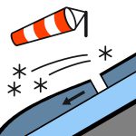
Wind Slab
Alpine
Size1/5
No recent activity observed A fine few days ahead. Wind from the South. Freezing level up to around 2000m. Icy conditions are to be expected, in creek beds, on slabs and at higher elevations.
The first snow fall of the winter was on 24/25th June, with about 10cm at 800m in the South of the forecasting area. There was less snow in the North, estimating about 10-20 cm above 1600m, on tussock, rock and slabs.
Source: New Zealand Avalanche Advisory · View Original Bulletin
Original (EN)
Open in the Avycast appNearby Regions
- Queenstown · 91 km
- Wanaka · 98 km
- Aspiring · 108 km
- Ohau · 188 km
- Aoraki/Mt Cook · 253 km
- Two Thumbs · 274 km