 AVYCAST
Two Thumbs — Лавинный прогноз
Лавинная опасность в регионе Two Thumbs (Новая Зеландия) — 3, Значительный, действует на воскресенье, 27 сентября 2026 г.. Публикует New Zealand Avalanche Advisory.
Значительные новые осадки быстро увеличат опасность лавин в воскресенье. Лучше всего избегать лавиноопасных участков до улучшения условий.
Опасность по высоте
Активные лавинные проблемы
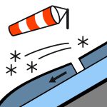
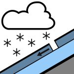
В районе не зафиксировано недавних лавин. Если вы заметите активность на хребте Two Thumb, пожалуйста, сообщите об этом публично. Это помогает нам создавать точные прогнозы. Снег выпадает перед рассветом, временами сильный выше 400 метров, к утру ослабевает до изолированных осадков и прояснения в послеобеденное время. Ветер на высоте 1000 метров западный 45 км/ч, к утру сменяется юго-западным 30 км/ч. Ветер на высоте 2000 метров западный штормовой 80 км/ч, повышающийся до сильного шторма 100 км/ч на открытых участках перед рассветом, затем ослабевает до юго-западного 55 км/ч в утренние часы. Уровень морозов 2400 метров, быстро понижается до 800 метров перед рассветом. Новые осадки частично снизят опасность скольжения. Однако ветровые доски на обнажённых склонах, вероятно, останутся твёрдыми, с множеством камней в зоне схода лавин. Рекомендуется иметь при себе лыжные кошки, ледоруб и кошки для ботинок, а также тщательно оценивать текущие условия.
В воскресенье ожидается более 20 см снега. Он будет распределён сильными юго-западными ветрами в глубокие наметы. Перед этим снегопадом снежный покров выглядел следующим образом: На солнечных склонах: В основном голая земля ниже примерно 1800 м. Остатки снега прошли через несколько циклов таяния и замерзания. На теневых склонах: В восточной части хорошее снежное покрытие выше 1600 м, достигающее 100–120 см в защищённых местах. Около 40 см на южных и юго-западных склонах. Вокруг хребтов и рельефных особенностей есть участки ветровых наметов холодного снега. В снежном покрове в теневых зонах присутствует множество слоёв корки, перемежающихся с слабыми кристаллами. Эта структура в настоящее время не представляет опасности, но при дальнейшем нагрузке может повысить риск лавин. Фотографии из района Camp Stream сделаны в среду.
Источник: New Zealand Avalanche Advisory · Открыть оригинал
Переведено (EN)
Частые вопросы
Что означает уровень лавинной опасности 3 (Значительный)?
Опасные условия — один человек может спустить лавину на многих крутых склонах; осторожный выбор маршрута обязателен.
Как часто обновляется прогноз для региона Two Thumbs?
Avycast обновляет данные ежечасно; New Zealand Avalanche Advisory переиздаёт бюллетень обычно раз в день в течение сезона.
Кто публикует лавинный прогноз для региона Two Thumbs?
New Zealand Avalanche Advisory — официальная лавинная служба. Avycast агрегирует и переводит его; всегда сверяйтесь с оригинальным бюллетенем.
Регионы рядом
- Aoraki/Mt Cook · 45 km
- Mt Hutt · 78 km
- Ohau · 87 km
- Craigieburn Range · 101 km
- Arthur's Pass · 118 km
- Aspiring · 173 km