 AVYCAST
Ohau — Boletín de aludes
El peligro de aludes en Ohau (Nueva Zelanda) es 3 — Notable, válido para lunes, 28 de septiembre de 2026. Publicado por New Zealand Avalanche Advisory.
Una tormenta fría de movimiento rápido traerá nieve abundante a niveles bajos el domingo. El peligro de aludes aumentará a medida que se acumule nieve fresca y luego se caliente. Tómese el tiempo para evaluar qué tan bien se está formando la unión en la nueva nieve, y esté atento a la rapidez con la que puede calentarse cuando está expuesta al sol.
Peligro por cota
Problemas de aludes activos
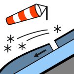

No se reportaron observaciones recientes de aludes en las últimas 48 horas. Al sur de Arthurs Pass: Nieve que se desarrolla antes del amanecer, a veces pesada por encima de los 400 metros, disminuyendo a lluvias aisladas en la mañana y despejando en la tarde. En otros lugares: Lluvia que se desarrolla en la mañana, posiblemente fuerte y cayendo como nieve por encima de los 500 metros. La lluvia disminuye en la tarde y despeja en la noche. viento en la cima del suroeste 50 km/h. nivel de congelación 600 ascendiendo a 1200 metros en la tarde. Existe un peligro serio de deslizamiento en la mañana cuando el manto nivoso está refreezado y duro. Lleve un piolet y crampones, y asegúrese de saber usarlos eficazmente. Considere las consecuencias de una caída antes de comprometerse con terreno empinado.
El manto nivoso está generalmente bien consolidado y tiene un carácter típico de primavera — firme y duro en la mañana, luego se ablanda gradualmente a medida que las temperaturas aumentan durante el día.
Fuente: New Zealand Avalanche Advisory · Ver boletín original
Traducido (EN)
Preguntas frecuentes
¿Qué significa el nivel de peligro de aludes 3 (Notable)?
Condiciones peligrosas — una sola persona puede desencadenar aludes en muchas laderas empinadas; es esencial elegir el itinerario con prudencia.
¿Con qué frecuencia se actualiza el boletín de Ohau?
Avycast se actualiza cada hora; New Zealand Avalanche Advisory vuelve a publicar el boletín normalmente una vez al día durante la temporada.
¿Quién publica el boletín de aludes de Ohau?
New Zealand Avalanche Advisory — el servicio oficial de alerta. Avycast lo agrega y lo traduce; consulta siempre el boletín original.
Regiones cercanas
- Aoraki/Mt Cook · 77 km
- Two Thumbs · 87 km
- Wanaka · 90 km
- Aspiring · 90 km
- Queenstown · 101 km
- Mt Hutt · 164 km