 AVYCAST
Nelson Lakes — Boletín de aludes
El peligro de aludes en Nelson Lakes (Nueva Zelanda) es 3 — Notable, válido para domingo, 27 de septiembre de 2026. Publicado por New Zealand Avalanche Advisory.
Actualmente, es posible la actividad de aludes de fondo húmedos y sueltos por debajo de los 2000m. Este peligro disminuirá durante el domingo a medida que el nivel de congelación descienda. La peligrosidad de placas de viento puede ser posible en aspectos orientados al este, particularmente en las elevaciones superiores.
Peligro por cota
Problemas de aludes activos
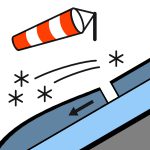

Sin observaciones. Por favor, proporcione cualquier observación sobre el manto nivoso o aludes utilizando el siguiente enlace. https://www.avalanche.net.nz/observations El nivel de congelación durante la noche de 2300m el sábado descenderá rápidamente a 1200m el domingo por la mañana. La nieve caerá hasta los 800m, a veces de forma intensa, y disminuirá en la tarde. Los vientos de fuerza de vendaval del oeste disminuirán a un viento fuerte del suroeste el domingo por la tarde. El nivel de congelación bajará a 1200m el domingo por la mañana y luego a 900m en la tarde. La nieve puede estar dura por encima de 2000m y más baja a medida que el nivel de congelación descienda en la mañana. ¡Necesitará un piolet y crampones!
La cobertura por encima de 1800m es razonablemente constante, particularmente en el oeste y sur del parque. La cobertura de nieve es intermitente por debajo de 1800m, especialmente en el norte y este del parque. 13mm de lluvia por debajo de 2000m han saturado el manto nivoso. Esto aumenta el peligro de aludes de fondo húmedos y sueltos. La nieve por encima de 2000m todavía puede ser transportada por el viento debido a las nevadas continuas por encima de esa elevación. Combinado con fuertes vientos del cuadrante oeste, esto sigue promoviendo el peligro de placas de viento en las elevaciones superiores.
Fuente: New Zealand Avalanche Advisory · Ver boletín original
Traducido (EN)
Preguntas frecuentes
¿Qué significa el nivel de peligro de aludes 3 (Notable)?
Condiciones peligrosas — una sola persona puede desencadenar aludes en muchas laderas empinadas; es esencial elegir el itinerario con prudencia.
¿Con qué frecuencia se actualiza el boletín de Nelson Lakes?
Avycast se actualiza cada hora; New Zealand Avalanche Advisory vuelve a publicar el boletín normalmente una vez al día durante la temporada.
¿Quién publica el boletín de aludes de Nelson Lakes?
New Zealand Avalanche Advisory — el servicio oficial de alerta. Avycast lo agrega y lo traduce; consulta siempre el boletín original.
Regiones cercanas
- Arthur's Pass · 142 km
- Craigieburn Range · 162 km
- Mt Hutt · 192 km
- Two Thumbs · 260 km
- Aoraki/Mt Cook · 276 km
- Taranaki · 314 km