 AVYCAST
Tongariro — Avalanche Forecast
The latest avalanche bulletin for Tongariro (New Zealand) was valid until Sunday, September 27, 2026 (danger 3 — Considerable). No newer forecast has been published — likely off-season.
This bulletin expired on Sunday, September 27, 2026 — no newer forecast has been published.
Wind slabs exist on east- and north-facing slopes. Fresh wind slabs are likely to form on south aspects as the storm system starts to affect the region. Loose wet avalanche hazard will develop at the lower elevations. The weather will deteriorate over the next 24 hours, with rain showers turning to snowfall and winds becoming strong and gale-force. Visibility will be poor, making navigation and hazard management challenging. Recommend delaying backcountry travel until conditions improve.
Danger by Elevation
Active Avalanche Problems
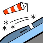

During slope assessment today (26092026), Whakapapa ski patrol triggered size 1 wind slab avalanches. These events were above 2000 metres elevation on aspects facing north and east. Sunday 27 September will have periods of heavy rain, with snow to 2100 metres at first, then lowering. Winds will be strong to gale north-westerly. The freezing level is about 2600 metres, lowering throughout Sunday. A warm front moves across the country today while a ridge of high pressure to the southeast drifts away. A strong cold front moves onto the bottom of the South Island tonight, preceded by strong north-westerly flow. Tomorrow, the front races north up the country, followed by strong, cold southwesterlies. Surface crusts can form quickly and may be icy and hazardous. Rime events can occur whenever conditions are favourable, leaving behind a solid crust. Even at sunset, refreezing can happen rapidly. A loss of footing can result in an uncontrolled slide, and there are numerous impact hazards such as exposed rocks and cliff bands. It is recommended to carry an ice axe and crampons when venturing into the backcountry. Strong alpine skills are essential for navigating slick surfaces, as the consequences of a sliding accident can be severe.
New snow accumulation over the past 24 hours was about 6 to 12 cm above 1900 metres elevation (Turoa). Light winds around Turoa, but stronger in the northern areas. This resulted in an even distribution in the southwest with good bonding to the old snow. The northern areas experienced more wind and snow transport, with a more defined wind slab forming. Recently, some weak snow has been identified (graupel). At lower elevations, the snowpack has matured after several melt-freeze cycles. The older, deeper snowpack has become consolidated and durable to rapid change. Ridgelines have been stripped, exposing an icy, rimed mass. At the lower elevations, snowpack erosion and a lifting snowline have continued, typical of spring. Waterfall holes and free-flowing water under unsupportive snow in gullies are an increasing hazard. Waterfall holes are a serious spring hazard and are mostly found in gullies at the lower elevations. Ice fall has recently been observed near Turoa. This unpredictable, dangerous hazard is more likely to occur during rapid warming events. The threshold is about 1900 metres in the northwestern areas. Isolated slopes above 1700 metres in the southwest are at the threshold, where avalanches can run without effective anchors.
Source: New Zealand Avalanche Advisory · View Original Bulletin
Original (EN)
Frequently asked questions
What does avalanche danger level 3 (Considerable) mean?
Dangerous avalanche conditions — a single person can trigger avalanches on many steep slopes; cautious route selection is essential.
How often is the Tongariro forecast updated?
Avycast refreshes hourly; the bulletin is republished by New Zealand Avalanche Advisory usually once a day during the season.
Who publishes the Tongariro avalanche forecast?
New Zealand Avalanche Advisory — the official warning service. Avycast aggregates and translates it; always check the original bulletin.
Nearby Regions
- Taranaki · 151 km
- Nelson Lakes · 387 km