Tongariro — Лавинный прогноз
Перевод выполняется — показан язык оригинала
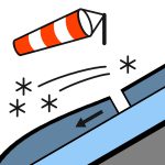
Wind slabs remain at the higher elevations on north and west-facing slopes. Refreeze is likely over the next 24 hours as freezing levels lower. This will make surface conditions icy and hard, increasing the chance of an uncontrolled slide. Snow cover is currently lean with plenty of hazards exposed. The weather is improving as high pressure brings settled conditions to the region.
Опасность по высоте
Активные лавинные проблемы
No natural or human-triggered avalanche activity has been observed or reported over the past 24 hours. Observations have been limited over the past few days due to poor weather conditions. Today, cloudy periods with a chance of a shower until evening. Monday the 29th, mainly fine, isolated showers developing in the morning. Winds remain moderate southerly and easing overnight. The freezing level is about 2500 metres, lowering to 1900 metres over the next 24 hours. The slow-moving low-pressure system to the northeast of the North Island continues to move away to the east today. Meanwhile, a ridge of high pressure will slowly extend over the country tomorrow. Areas where the snow has become wet will refreeze. Freezing levels are forecasted to lower, resulting in an icy surface crust. The early-season snow cover exists with lots of exposed rocks and cliff bands. It's essential to carry the appropriate gear, crampons, and an ice axe. The surface conditions can be unforgiving, and being prepared with the targeted skill set will reduce the chance of an accident.
Good visibility has made it obvious that most of the storm snow accumulation was concentrated in the east and south of the region. Periods of drizzle over the past 24 hours have saturated the new snow below 2100 metres. Below 2100 metres, expect this wet new snow to refreeze once freezing levels are lower over the next 24 hours. Moving around will become hazardous once refreeze occurs. Wind-transported snow has formed slabs at the higher elevations (above 2100 metres). Expect weaknesses within these new snow deposits to remain, but gaining strength over the coming days. Recent storm snow totals have been disappointing, but snowpack development is heading in the right direction above 1900 metres. Below 2100 metres, irregular terrain and rocks the size of cars are still exposed. The snow cover threshold is 2100 metres. Isolated slopes above 2100 metres will have enough cover for avalanches to run.
Источник: New Zealand Avalanche Advisory · Открыть оригинал
Оригинал (EN)
Открыть в приложении AvycastРегионы рядом
- Taranaki · 151 km
- Nelson Lakes · 387 km