 AVYCAST
Torridon — Avalanche Forecast
The latest avalanche bulletin for Torridon (United Kingdom) was valid until Tuesday, April 7, 2026 (danger 1 — Low). No newer forecast has been published — likely off-season.
This bulletin expired on Tuesday, April 7, 2026 — no newer forecast has been published.
Danger by Elevation
Active Avalanche Problems


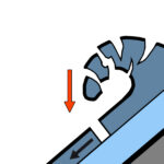
Forecast Snow Stability: The snowpack will thaw and consolidate in the mild temperatures. Any instabilities that remain in deeper deposits on North-East to South-East aspects will consolidate through the day. Surface instabilities possible on steep slopes exposed to the sun. Any remaining cornices will be prone to collapse. The avalanche hazard will be Low.
Forecast Weather Influences: A very mild day with strong South-Easterly winds. Dry for most of the day with rain developing towards the end of the afternoon. Observed Weather Influences: A dry day with increasing South-South-Easterly winds. The freezing level rose above the summits. ObservedSnowStability: The snowpack is gradually consolidating. However instabilities remain in recent windslab deposits. Steep North-East to South-East aspects above 750 metres are most affected. The avalanche hazard is Moderate.
Source: SAIS · View Original Bulletin
Original (EN)
Frequently asked questions
What does avalanche danger level 1 (Low) mean?
Generally favourable conditions — avalanches are possible mainly with high additional load on very steep terrain.
How often is the Torridon forecast updated?
Avycast refreshes hourly; the bulletin is republished by SAIS usually once a day during the season.
Who publishes the Torridon avalanche forecast?
SAIS — the official warning service. Avycast aggregates and translates it; always check the original bulletin.
Nearby Regions
- Creag Meagaidh · 82 km
- Lochaber · 86 km
- Glencoe · 100 km
- Northern Cairngorms · 116 km
- Southern Cairngorms · 129 km