 AVYCAST
Ubaye — Avalanche Forecast
Avalanche danger in Ubaye (France) is 2 — Moderate, valid for Sunday, November 15, 2026. Published by Meteo France.
Danger by Elevation
Active Avalanche Problems

Problems extracted by AI from bulletin text. May be inaccurate.
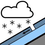
NEW INSTABILITIES FORMING AT ALTITUDE Triggering caused: in Haute-Ubaye, on north-facing slopes from around 2800/3000 m, new easy-to-trigger slabs form during the night from Saturday to Sunday, on a snowpack that already includes slightly thicker accumulations and some buried weak layers. Medium-size avalanches (size 2) are thus possible. Across the entire massif, above 2500/2600 m, small slabs also form on north-facing slopes. They are located mainly in the accumulations near high ridges and summits and are rather easy to trigger. Small avalanches (size 1). During Sunday daytime, the strengthening west/southwest wind also maintains these instabilities. At lower altitudes, the avalanche danger remains low or nonexistent, as snow settles on bare ground or only partially snow-covered ground. Spontaneous releases: a few small releases of fresh surface snow during or after the snowfall, only on steep north-facing slopes that were previously snow-covered.
Snow cover assessment: deficient for mid-November. There is no snow at the Nivôse station at Restefond at 2550 m. In 32 years of measurements, this is only the fourth time it has been zero on November 14. Limits for skiable snow: skiing appears to be possible only on rare routes in Haute-Ubaye, where you can put on skis from 2500/2600 m in the most favorable locations. Sunday morning, if the new snowfall is there, it may allow temporary access to lower altitudes (around 1800 m?), but only on very favorable grassy terrain. Condition of the surface snow: Sunday morning, a layer of fresh snow 10 to 30 cm thick is found depending on altitude. It settles on a snowpack that is already established on north-facing slopes above 2500/2600 m. Elsewhere, it falls on a discontinuous snowpack or directly on the ground.
Source: Meteo France · View Original Bulletin
Translated (FR)
Frequently asked questions
What does avalanche danger level 2 (Moderate) mean?
Heightened avalanche conditions on some steep slopes — careful route selection and terrain evaluation are needed.
How often is the Ubaye forecast updated?
Avycast refreshes hourly; the bulletin is republished by Meteo France usually once a day during the season.
Who publishes the Ubaye avalanche forecast?
Meteo France — the official warning service. Avycast aggregates and translates it; always check the original bulletin.
Nearby Regions
- Embrunals-Parpaillon · 9 km
- Queyras · 25 km
- Mercantour · 41 km
- PIEMONTE / Alpi Cozie nord · 47 km
- PIEMONTE / Alpi Cozie sud · 47 km
- Alpi Cozie Sud · 47 km