 AVYCAST
Aravis — Avalanche Forecast
Avalanche danger in Aravis (France) is 1 — Low, valid for Sunday, November 15, 2026. Published by Meteo France.
Translation in progress — shown in source language
Danger by Elevation
Active Avalanche Problems
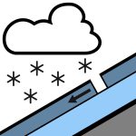
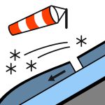

Problems extracted by AI from bulletin text. May be inaccurate.
Massif très faiblement enneigé. Enneigement non significatif. Les épaisseurs en place sont insuffisantes pour envisager d'éventuelles structures de plaques.
Enneigement très faible. Blanchit à partir de 1800 m, Fine couche de neige à partir de 2000/2200 m. Sous-couche présente au-dessus de 2400/2500 m. Qualité de la neige dimanche :Entre 2200 et 2500 m : 10 cm de neige fraiche.Sur les plus hauts sommets : 10/15 cm de neige fraiche ventée, sur un fond de 20/30 cm de neige récente.
Source: Meteo France · View Original Bulletin
Original (FR)
Frequently asked questions
What does avalanche danger level 1 (Low) mean?
Generally favourable conditions — avalanches are possible mainly with high additional load on very steep terrain.
How often is the Aravis forecast updated?
Avycast refreshes hourly; the bulletin is republished by Meteo France usually once a day during the season.
Who publishes the Aravis avalanche forecast?
Meteo France — the official warning service. Avycast aggregates and translates it; always check the original bulletin.
Nearby Regions
- Beaufortain · 19 km
- Bauges · 30 km
- Mont-Blanc · 31 km
- VAL VENY · 33 km
- VALLE DI LA THUILE · 40 km
- VAL FERRET · 41 km