 AVYCAST
Jacetania — Avalanche Forecast
The latest avalanche bulletin for Jacetania (Spain) was valid until Monday, May 4, 2026 (danger 2 — Moderate). No newer forecast has been published — likely off-season.
This bulletin expired on Monday, May 4, 2026 — no newer forecast has been published.
Danger by Elevation
Active Avalanche Problems
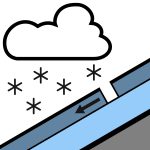

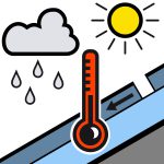
Problems extracted by AI from bulletin text. May be inaccurate.
Recent snowfall problems and wind slabs at high elevations. Wet snow problems and basal sluffs. Precipitation is expected in the coming hours, with the snow level dropping to around 2000 meters, which may accumulate about 10-30 cm of new snow at high elevations, locally more. Below about 2500 meters, much of the precipitation will fall as rain or very wet snow, so wet snow avalanches will remain likely on sufficiently steep slopes of any aspect, especially during showers. In general they will be small in size (falling hazard), in some cases medium (capable of burying a person), although some basal sluff may occur on grassy slopes or smooth rock that could become more significant. Above about 2500 meters, it is likely that the new snow will not bond well with the preexisting snowpack, so purges of more dry recent snow may occur. In addition, with the southwest flow, some fragile wind slabs may form on north-facing aspects, which could collapse with the passage of a single skier. Both types of avalanches will generally be of small size, or at most medium.
During yesterday’s day, significant precipitation was recorded in the mountain range, which in many areas has ranged around 30-50 l/m2, locally more than 70 l/m2, and fell as snow only in the high mountains. Thus, a few centimeters of new snow have been able to accumulate above about 2600 meters, while at lower elevations the snowpack has continued to be involved in melt and wetting processes, as has been happening for days. The snowpack shows some continuity at high elevations, although the sunny slopes are quite devoid of snow up to considerable altitudes and rocky outcrops are frequent on shady slopes. Despite this, due to the heavy snowfall recorded this season, snow depths are still significant above 2200-2400 meters, where they reach 40-100 cm in some locations. The snowpack consists of very dense old snow, and rounded grains predominate, with some crusted layers interspersed within. Given the precipitation expected for today, above about 2400-2500 meters a few more centimeters of drier snow may be deposited, which could fail to bond well with the previous snowpack.
Source: AEMET · View Original Bulletin
Translated (ES)
Frequently asked questions
What does avalanche danger level 2 (Moderate) mean?
Heightened avalanche conditions on some steep slopes — careful route selection and terrain evaluation are needed.
How often is the Jacetania forecast updated?
Avycast refreshes hourly; the bulletin is republished by AEMET usually once a day during the season.
Who publishes the Jacetania avalanche forecast?
AEMET — the official warning service. Avycast aggregates and translates it; always check the original bulletin.
Nearby Regions
- Alto Gállego · 35 km
- Aspe-Ossau · 38 km
- Sobrarbe · 76 km
- Haute-Bigorre · 83 km
- Aure-Louron · 86 km
- Spain · 102 km