 AVYCAST
Birkenhead-Duffey-South Chilcotin-Stein-Taseko — Avalanche Forecast
The latest avalanche bulletin for Birkenhead-Duffey-South Chilcotin-Stein-Taseko (Canada) was valid until Wednesday, April 15, 2026 (danger 2 — Moderate). No newer forecast has been published — likely off-season.
This bulletin expired on Wednesday, April 15, 2026 — no newer forecast has been published.
Human-triggered avalanches are possible. Use caution as you transition into wind-affected terrain.
Danger by Elevation
Active Avalanche Problems
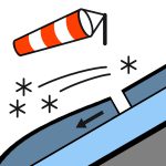
Tuesday’s storm follows a period of low danger and limited avalanche activity.Looking ahead, concerns shift to the new snow forming wind slabs, and eventually wet loose avalanches with sun and warming.If you go into the backcountry, support the forecast by posting a MIN.
10 to 20 cm of new snow is expected by the end of Tuesday. This new snow overlies a melt-freeze crust, moist snow, or isothermal conditions, depending on aspect and elevation.The snowpack has undergone multiple warming and cooling cycles, forming a series of crusts interspersed with dense, rounded grains.
Source: Avalanche Canada — Avalanche Canada · View Original Bulletin
Original (EN)
Frequently asked questions
What does avalanche danger level 2 (Moderate) mean?
Heightened avalanche conditions on some steep slopes — careful route selection and terrain evaluation are needed.
How often is the Birkenhead-Duffey-South Chilcotin-Stein-Taseko forecast updated?
Avycast refreshes hourly; the bulletin is republished by Avalanche Canada — Avalanche Canada usually once a day during the season.
Who publishes the Birkenhead-Duffey-South Chilcotin-Stein-Taseko avalanche forecast?
Avalanche Canada — Avalanche Canada — the official warning service. Avycast aggregates and translates it; always check the original bulletin.
Nearby Regions
- Birkenhead-Brandywine-Duffey-Garibaldi-Homathko-South · 30 km
- Brandywine-Garibaldi-Homathko-North Shore-Powell River · 82 km
- Brandywine-Garibaldi-Homathko-Powell River-Spearhead · 83 km
- Birkenhead-Brandywine-Coquihalla-Duffey-East Island · 91 km
- Coquihalla-Harrison-Fraser-Manning-North Shore-Powell River · 117 km
- Coquihalla-Harrison-Fraser-Manning-North Shore-Sasquatch · 157 km