 AVYCAST
Banff-East Side 93N-Field-Kootenay-Lake Louise-Little Yoho — Lawinenlagebericht
Die Lawinengefahr in Banff-East Side 93N-Field-Kootenay-Lake Louise-Little Yoho (Kanada) ist 1 — Gering, gültig für Dienstag, 17. November 2026. Veröffentlicht von Avalanche Canada — Parks Canada.
Übersetzung läuft — Anzeige in Originalsprache
Watch for deeper snow accumulation and slab formation in isolated alpine gully features. Climbers should watch for small wind slabs that can have serious consequences.
Gefahr nach Höhenlage
Aktive Lawinenprobleme
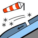
Reports are limited, but there have been no recent avalanche observations; only minor sluffing/cracking in steep alpine terrain. The main snowpack concern is small, isolated wind slabs in alpine gullies.
A surface crust to ridgetop. Previous snowfall of 5–15 cm, combined with strong SW–SE winds, has formed wind slabs in the alpine. This snow and wind slabs overlie 20–30 cm of faceted snow at higher elevations. Reports indicate snow depths of up to 80 cm on glaciers, while snow cover remains minimal at treeline and below. Overall, the early-season snowpack is thin and variable.
Quelle: Avalanche Canada — Parks Canada · Original-Lagebericht ansehen
Original (EN)
Häufige Fragen
Was bedeutet Lawinengefahrenstufe 1 (Gering)?
Allgemein günstige Verhältnisse — Lawinen sind vor allem bei großer Zusatzbelastung im sehr steilen Gelände möglich.
Wie oft wird der Lagebericht für Banff-East Side 93N-Field-Kootenay-Lake Louise-Little Yoho aktualisiert?
Avycast aktualisiert stündlich; Avalanche Canada — Parks Canada veröffentlicht den Lagebericht in der Saison meist einmal täglich neu.
Wer veröffentlicht den Lawinenlagebericht für Banff-East Side 93N-Field-Kootenay-Lake Louise-Little Yoho?
Avalanche Canada — Parks Canada — der offizielle Lawinenwarndienst. Avycast bündelt und übersetzt ihn; prüfe immer den Originalbericht.
Regionen in der Nähe
- Bow Valley-Highwood Pass-North 40-Spray - KLakes · 94 km
- Glacier · 96 km
- Dogtooth-East Purcell-West Purcell · 98 km
- Badshot-Battle-Central Selkirk-Esplanade-Goat-North Selkirk · 119 km
- Crawford-Dogtooth-East Purcell-Moyie-St. Mary-West Purcell · 153 km
- Brazeau-Churchill-Cirrus-Wilson-Fryatt-Icefields-Maligne · 165 km